
Zielonogórska Biblioteka Cyfrowa udostępnia 67 626 obiektów cyfrowych
Obiekt
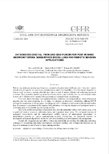
Tytuł: Integrated Digital Twin and Geo-Fusion for Post-Mining Geomonitoring: Subsurface Modelling and Remote Sensing Applications
Współtwórca:
Tytuł publikacji grupowej:
Abstract:
Post-mining landscapes present significant environmental and geotechnical challenges due to long-term impacts of underground exploitation, such as ground deformation, subsurface instability, and environmental degradation. Conventional monitoring methods often fall short due to a lack of surface indicators of underlying geological structures. Thus, accurately identifying subsurface discontinuities - such as faults, cavities, and weakened zones is essential for effective environmental risk assessment and sustainable land-use planning. Previously, these challenges were approached using traditional surveying methods, which often lacked precision and were time-consuming. ; In this study, we introduce an innovative methodology utilizing MOVE software for comprehensive 3D geological modelling and UAV multispectral surveys to acquire detailed surface data. The process is complemented by rigorous field validation, involving the integration of geological, tectonic, and mining maps with borehole logs and seismic profiles. Our results confirm the presence of persistent subsurface discontinuities in historically mined areas, often aligned with tectonic structures, subsidence lakes, and vegetation stress zones. ; This enhanced mapping of geological discontinuities and the comprehensive stability analysis of embankments demonstrate the methodology`s potential to improve geomonitoring accuracy. Furthermore, our framework supports the development of dynamic digital twin models for predictive modelling and environmental risk management. Overall, this integrated approach offers a robust and transferable methodology for addressing subsurface challenges in post-mining and similar environments, ultimately enabling more informed decision-making and long-term planning in areas affected by legacy mining activities.
Opis:
tytuł dodatkowy: Prace z Inżynierii Lądowej i Środowiska
Wydawca:
Zielona Góra: Oficyna Wydawnicza Uniwersytetu Zielonogórskiego
Format:
Identyfikator zasobu:
DOI:
Strony:
Źródło:
Civil and Environmental Engineering Reports (CEER), no 35, vol. 3
Jezyk:
Licencja:
Licencja CC BY 4.0:
Prawa do dysponowania publikacją:
Biblioteka Uniwersytetu Zielonogórskiego
Kolekcje, do których przypisany jest obiekt:
- Zielonogórska Biblioteka Cyfrowa > Repozytorium > Jednostki organizacyjne > Wydział Budownictwa, Architektury i Inżynierii Środowiska
- Zielonogórska Biblioteka Cyfrowa > Repozytorium > Typy utworów > Artykuły
- Zielonogórska Biblioteka Cyfrowa > Repozytorium > Czasopisma naukowe i serie wydawnicze UZ > Civil and Environmental Engineering Reports (CEER) > Civil and Environmental Engineering Reports (CEER) (2025)
Data ostatniej modyfikacji:
16 lip 2026
Data dodania obiektu:
16 lip 2026
Liczba wyświetleń treści obiektu:
70
Wszystkie dostępne wersje tego obiektu:
https://www.zbc.uz.zgora.pl/publication/109050
Wyświetl opis w formacie RDF:
Wyświetl opis w formacie OAI-PMH:
| Nazwa wydania | Data |
|---|---|
| Integrated Digital Twin and Geo-Fusion for Post-Mining Geomonitoring: Subsurface Modelling and Remote Sensing Applications | 16 lip 2026 |
Obiekty Podobne
Kasztelewicz, Zbigniew Klich, Jerzy Sypniowski, Szymon Greinert, Andrzej - red. Kołodziejczyk, Urszula - red.
Drab, Michał Greinert, Andrzej Świtka, Romuald - red.
Pawlik, Marcin Nguy, Quynh Anh Bernsdorf, Bodo Rudolph, Tobias Haske, Benjamin Kuczyński, Tadeusz - red.
Greinert, Henryk Greinert, Andrzej Drab, Michał Greinert, Andrzej - red. Kołodziejczyk, Urszula - red.
Jachimko, Barbara Kruk, Tomasz Greinert, Andrzej - red. Kołodziejczyk, Urszula - red.
Galiniak, Grzegorz Jarosz, Jerzy Greinert, Andrzej - red. Kołodziejczyk, Urszula - red.
Cuske, Mateusz Pora, Ewa Musztyfaga, Elżbieta Gałka, Bernard Greinert, Andrzej - red.
Pająk, Marek Krzaklewski, Wojciech Pietrzykowski, Marcin Likus, Justyna Kowalczewski, Wojciech Greinert, Andrzej - red.
